Looking for a challenging and at times a bit sketchy hike? Look no further than the Rock of Ages hike on the Oregon side of the Columbia River Gorge. This ten mile long loop hike serves up some serious terrain jam packed with steeps, bushwhacking, hand over foot climbing, amazing views, waterfalls and massive elevation gain.
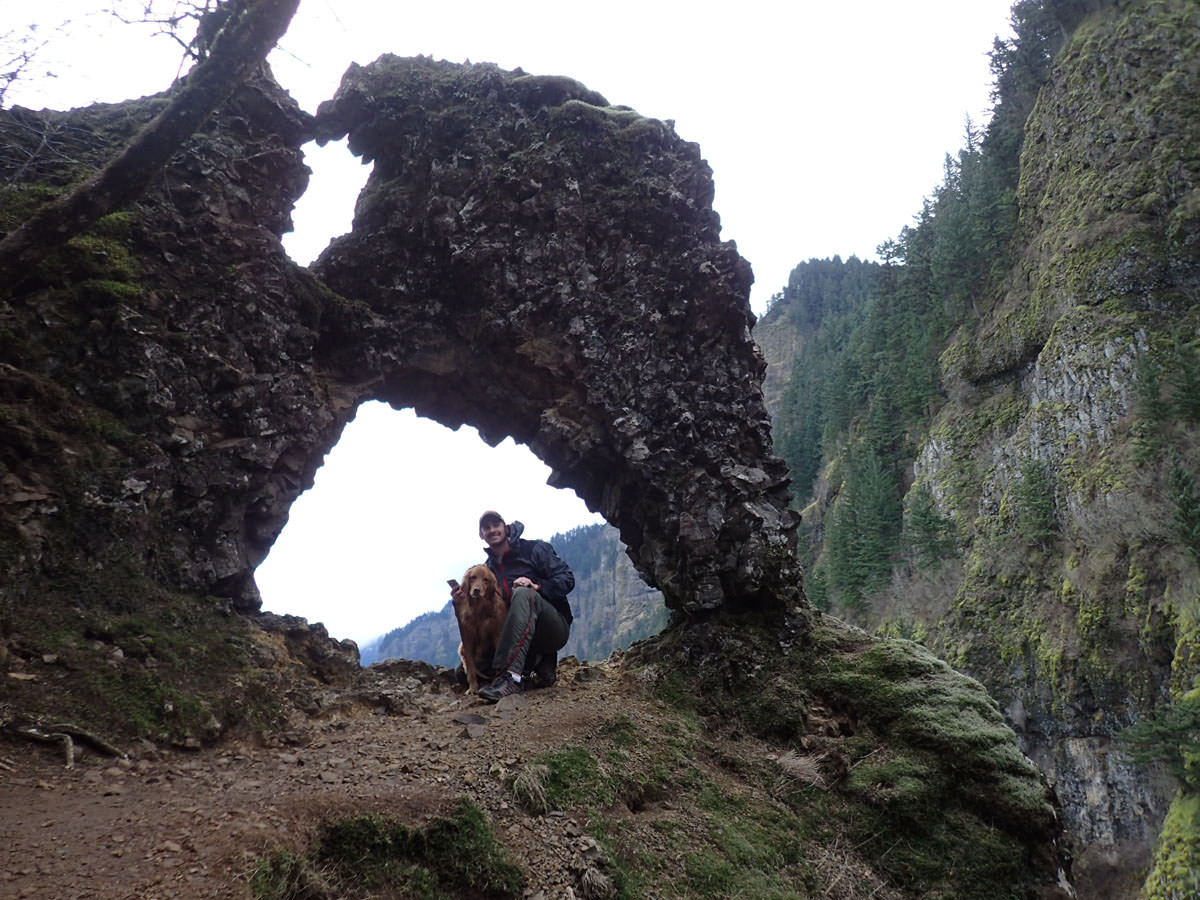
The Rock of Ages, a large rock formation that creates an arch acting as a natural picture frame encasing the Columbia River Gorge, is the main attraction of this hike. It seems to be one of those elusive places that you see or hear about but can’t ever really figure out how to get there. This is for good reason, as the trail to Rock of Ages is all but a staircase climb straight up the walls of the mighty Columbia River Gorge.
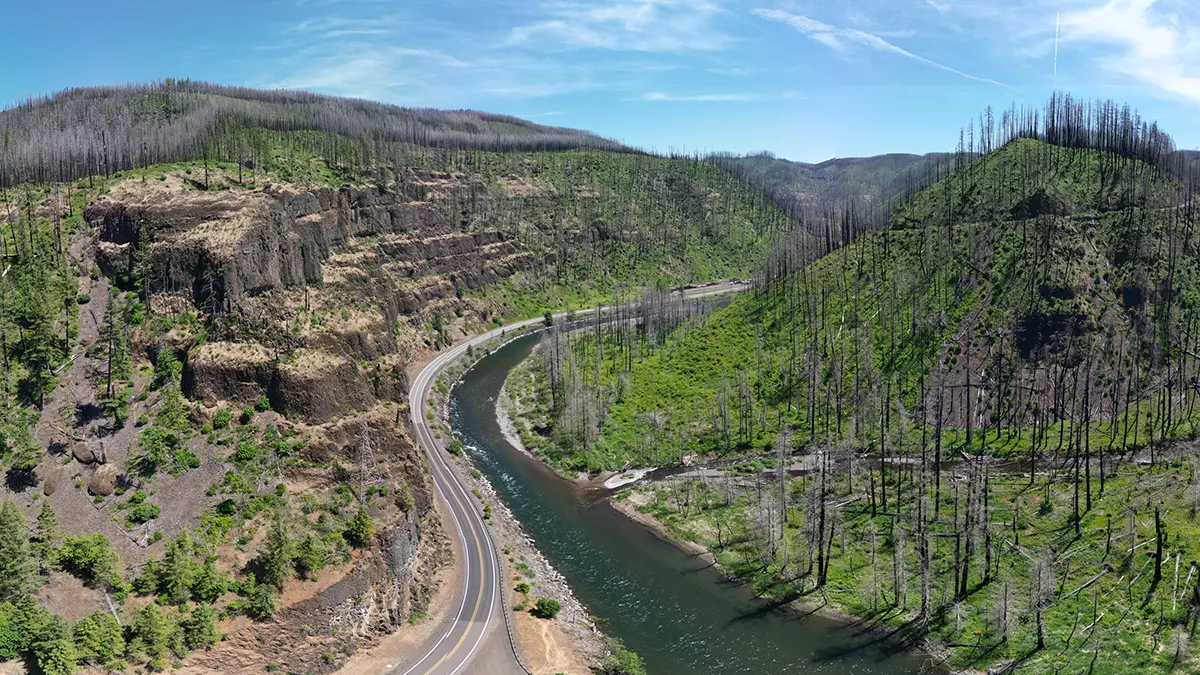
Along this hike you will see Horsetail Falls, Ponytail Falls, The Rock of Ages, St. Peter’s Dome. Devil’s Backbone, Triple Falls, Oneonta Creek, views into Oneonta Gorge, middle Oneonta Falls, the top of lower Oneonta Falls, and many, many viewpoints. If you are looking to pack as much awesomeness into one hike as possible, continue reading.
The Rock of Ages Hike
It is best advised to do the entire Rock of Ages loop hike rather than just the short out and back option. Doing the full loop will allow you to see all the attractions this area has to offer beyond just the Rock of Ages. The loop hike is approximately 10 miles long and gains more than 3,000 feet of elevation within the first thee miles of the hike. You can expect hand over foot climbing and be prepared to get lost or at least mildly disoriented. We are going to leave the full hike write-up to the experts at oregonhikers.com but keep reading for some tips on how to actually find the trail and avoid getting lost.
Finding the Rock of Ages trail
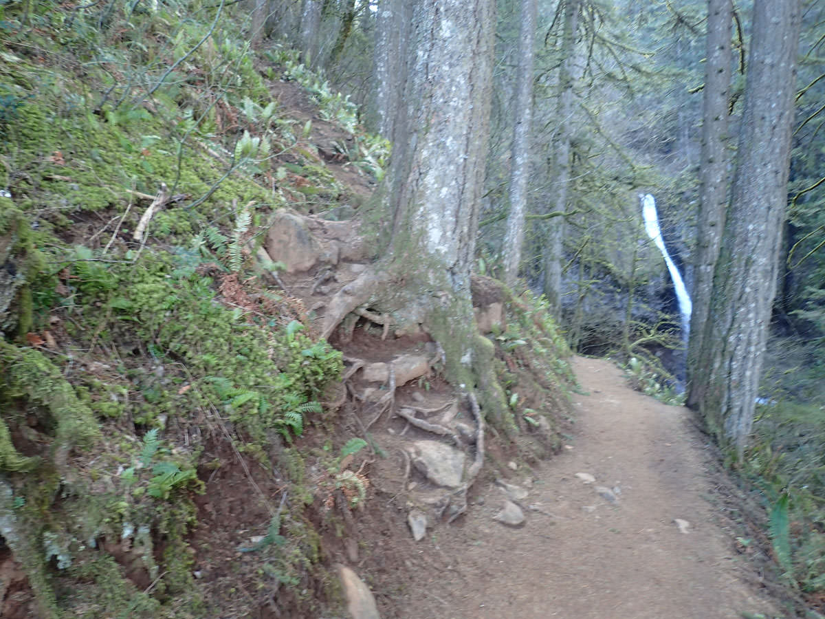
The Rock of Ages “trail” is really not a trail but more of a side path that goes on and on and on. You have likely seen game trails that are more obvious than this one. The hike starts out at the Horsetail Falls parking lot and heads up towards Ponytail Falls less than a half mile away. As you approach Ponytail Falls keep an eye out on your left hand side for a vague trail heading straight up the mountain side. The trail will become visible almost at the exact same time as the view of Ponytail Falls becomes visible. In other words – while you are distracted by Ponytail Falls straight ahead of you there is a chance you will miss the trail to Rock of Ages on your left.
Once you actually find the trail you will proceed to head straight up the mountain with little to no switchbacks. This is where it gets a bit tricky…. because there is no defined trail people seem to have made their own and it has resulted in a many different trails going all over the place. The key here is to try and stick to the most obviously used trail. As you head up you will want to keep an eye out for a trail that meanders towards your left. This is where you will head off to the Rock of Ages. You will know when you get there because you will soon become halfway cliffed out.
After the Rock of Ages you will continue to follow the trail all the way up another 2,000 vertical feet. It can still be tricky and easy to get lost so pay close attention to the trail and look for signs of previous hikers. You will climb and soon reach Devil’s Backbone which on a nice day offers some great views of the Gorge. From Devil’s Backbone you will continue up the mountain until you finally reach the pinnacle of this grueling hike where you are dumped onto an actual hiking trail called Horstail Creek Trail #425. After all the climbing and searching for signs of the Rock of Ages trail this is going to feel like a freeway. From here on out the hike is fairly obvious though you still have about 7 miles to go. Follow the Oregon Hikers Rock of Ages guide and you should be able to find your way back.
What to Bring on the Rock of Ages Hike
Like all hikes in Oregon you are going to want to be well equipped in case the weather takes a change for the worse. This hike gains some serious elevation and you could start out at the trail head with sun but quickly find yourself in a snowstorm depending on the time of year. Hike boots are recommended due to the loose rock and scrambling involved and trekking poles could be a big help as well. There is little to no water on the first few hours of this hike so be sure to bring plenty to drink and lots of fuel to help you up the more than 3,000 vertical ft climb. Bring a friend. This is not a good trail to solo hike due to its lack of traffic and dangerous sections.
If you are bringing your dog please at the very least make sure they have a harness on as there are some very difficult sections of the trail in which your four legged friend could struggle or even fall (as in fall off a cliff and most likely die). This trail is doable with a dog but you will want to pay extra attention to them in the steeper sections.
An Awesome Hike you won’t want to do again
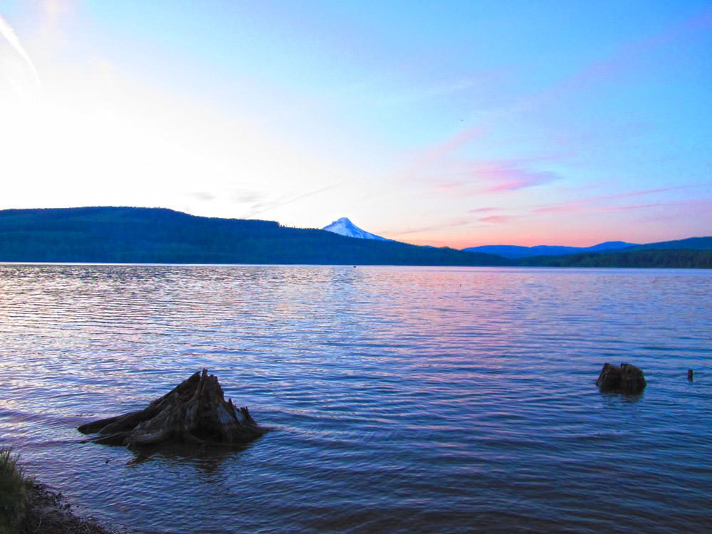
Overall the Rock of Ages hike is an amazing challenge that will put your fitness and mental fortitude to the test. The hike is painfully steep at points but the constant views keep you from thinking about the pain in your legs. We think this hike is a “must do” for anyone that considers themselves and avid outdoorsy Northwesterner but we bet once you have done it you won’t be eager to do it again.
Rock of Ages Hike Photos


Responses
My husband and I just did this hike last Saturday (6.13.2015) on a perfect mid 70º day… SO GOOD. We are both native Oregonians–the rural southern half of many generations past– and have lived in Portland for around a decade each. We hemmed and hawed about bringing our dog and damn, very happy we didn’t. We would maybe have made it to the Rock Arch with him, but once the real scrambling happened, along with the cliffs, it would have been a sad time. This is definitely a taxing, but very doable hike for anyone in good overall fitness who doesn’t skip leg day. 😉 Beautiful views and lovely creeks to stop at for fresh water and a snack break.
Hey Dawn- Glad to hear you enjoyed the hike! Definitely a difficult one and not exactly dog friendly. In the end though, totally worth it. Thanks for sharing your hike with us!
For anyone considering this hike the trail near triple falls has been repaired and is now open again. Here is the trip report for that section: http://www.oregonhikers.org/forum/search.php?terms=all&author=&fid%5B%5D=8&sc=1&sf=all&sk=t&sd=d&sr=posts&st=0&ch=300&t=0&submit=Search&keywords=Triple+Falls+Hike
Wish I had seen this before my hike. I went solo, missed the “trail” and hiked the loop backwards. Descending was no picnic as following the trail I couldn’t find was pretty difficult and definitely was lured onto some false trails. This hike is no joke but amazing.
Wow… ya I would not want to come down that steep section. Much easier going up. Thanks for sharing!